On Tues Oct 12, I attended the launch of a new report called “THE SCARBOROUGH OPPORTUNITY: A Comprehensive Walking and Cycling Network” authored by Professor Andre Sorensen and Human Geography students from the University of Toronto Scarborough (UTSC). Being a walking enthusiast from Scarborough, I read the report with interest on Wed Oct 13, along with a related Toronto Star article. Yesterday, I was inspired to do some ‘citizen science’ on a utilitarian walk to my local drug/grocery store in Scarborough-Agincourt. I headed out with my smart phone, a small note pad and pen, a tape measure, and some ideas about what I would investigate based on my reading of the report.
Below are some quotes from the report, along with illustrative photos of my walk to the drug/grocery store, and some comments. The two way trip was 2km, mainly along Davisbrook Blvd and Huntingwood Drive to the Warden Plaza Shopping Mall on Warden Avenue and back.
The following quote is from page 18 in the section of the report describing Scarborough’s urban form:
Local streets were designed to be inconvenient for
through trips, with winding street patterns and many looped streets, partly to ensure safety for pedestrians and especially children walking to school. Such “neighbourhood units,” with schools and parks in the center of superblocks defined by arterial roads, were one of the main modernist ideas of the middle of the 20th century, designed to accommodate rapidly increasing automobile traffic and the shift of population to residential suburbs far from the city centre and existing public transit systems.27
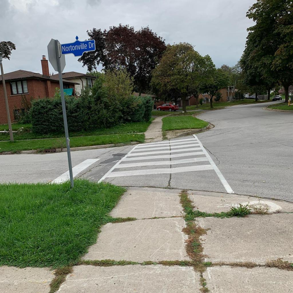
Nortonville Drive off of Davisbrook Blvd and connecting to Wardencourt Drive is an example of a winding street pattern, though the closest school is on the other side of Bay Mills Blvd. Considering the speed limit of 40km/hr on Bay Mills Blvd, some motorists still seem to drive too fast along this boulevard connecting Sheppard Ave E and Birchmount Road. Bus stops in the area are located to the south on Sheppard Ave E, to the north and north-east on Huntingwood Drive and to the west on Warden Avenue.
The following quote is from page 35 in the section of the report describing the existing pedestrian network in Scarborough:
Sidewalks and safe crossings are the bare minimum of a
comprehensive pedestrian network, and these deficits must be rectified. But to encourage walking, it is not enough to simply ensure the safety of pedestrians; the City needs to create an environment where walking is joyful and pleasant. Doing so means making sure there is shade (for example, through trees), benches, beauty, places of interest along the way, and a comprehensive network of routes that allow walking to be a better option for more short trips.
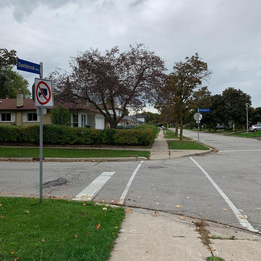
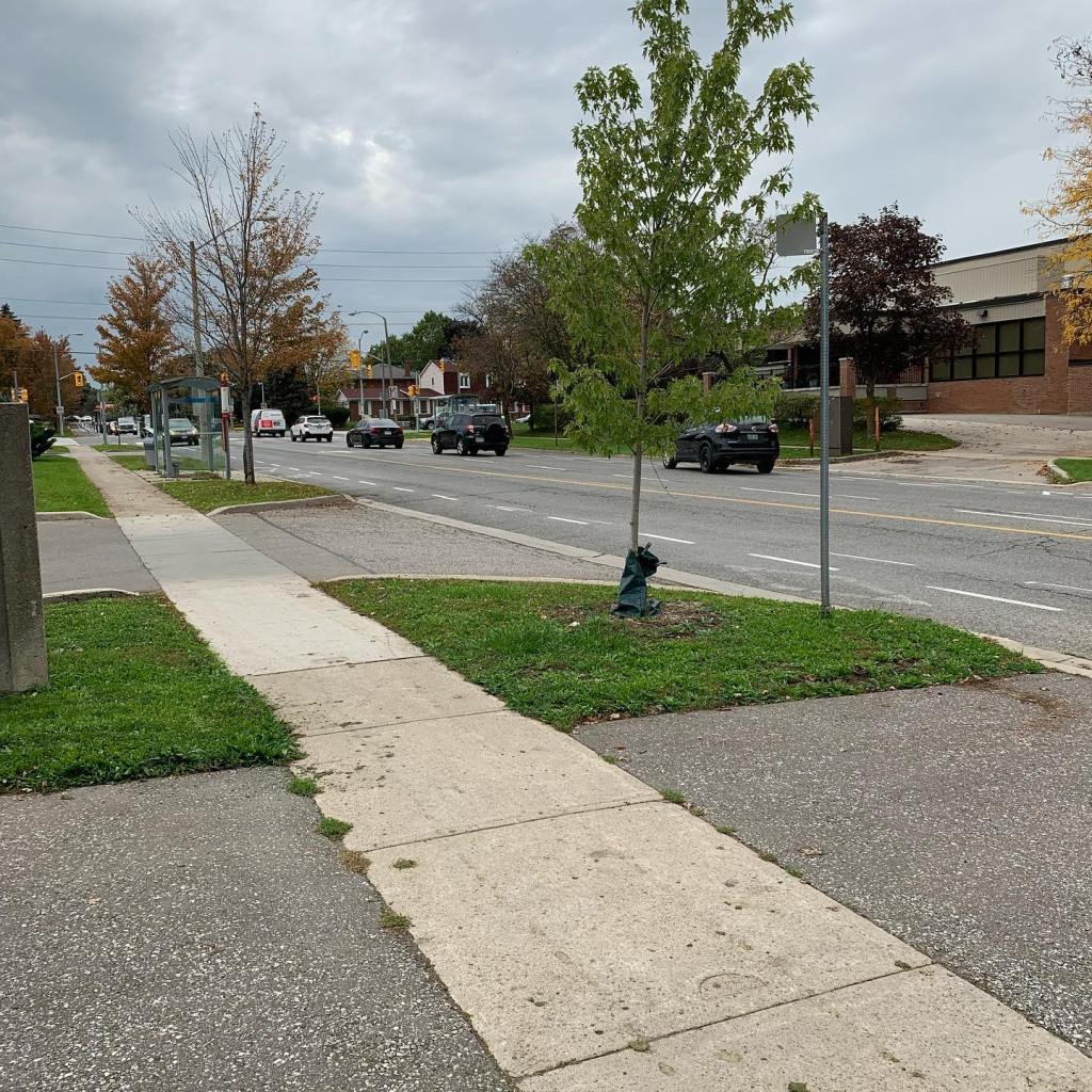
The walk along Davisbrook Blvd, and other streets in this area, generally feels safe and pleasant because of the grassy areas separating the sidewalks from the streets, as well as the abundance of trees. A particularly beautiful tree-lined street is Wardencourt Drive, which connects Davisbrook Blvd to Warden Avenue. According to the report, and illustrated by a photo on page 35, “Figure 5.1: Narrow Sidewalk Abutting Fast-Moving Traffic, Eglinton Avenue East near Markham Road”, many sidewalks in Scarborough do not feel safe, comfortable or pleasant.
The following quote is from page 37 in the section of the report on recommendations for the comprehensive pedestrian network:
The pedestrian network should ensure connectivity, convenience for pedestrians, safety, accessibility, comfort, enhanced mobility options for everyone, and an attractive public realm to make all trips more interesting and enjoyable. Since sidewalks serve everyone and are essential for the first and last mile of many trips, the need for improvements to the quality of sidewalks is pressing. The City can provide a safer and more pleasant experience for pedestrians by:
• Widening the width of all sidewalks in the comprehensive network to a minimum of 2.1m to ensure comfort and safety;

I took this sidewalk width measurement on Davisbrook Blvd near Marblemount Cres and it is typical of the width along this sidewalk. At 140cm it is less than the recommended 210cm. Although it does not feel unsafe to walk along this sidewalk because there is grass separating the sidewalk from the street, it does feel uncomfortable to have to step over onto the grass in order to give someone more room, especially while carrying grocery bags. Such a maneuver for older adults who might have balance issues could post a safely risk.
The following quotes are from pages 15 and 16 in the section of the report on cycling frameworks:
The Second Quarter Update of the Near-Term
Implementation Program was released in May 2021,
identifying cycling infrastructure projects proposed in 2021 and 2022.24The current reconstruction project for Port Union
Road noted above includes sidewalks and bicycle lanes
along a 2km corridor from Lawrence Avenue East to
Island Road.26 This project is included in the Near-Term
Capital Implementation Program (2019-2021). The cycle
lanes on Huntingwood Drive in the northwest corner of
Scarborough have been completed, but those on Eglinton Avenue East from Victoria Park Avenue to Kennedy Road have been delayed by the Eglinton Crosstown transit project.
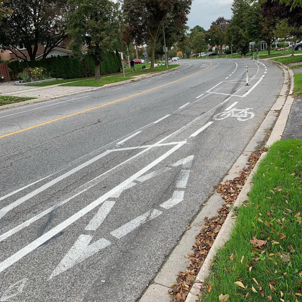
This is Huntingwood Drive looking north-east showing the cycle lanes on both sides of the street. Since I have not cycled in about 15 years, I invite anyone who has experience with cycling on these lanes to share their thoughts and feelings. If I were to decide to take up cycling again, I would start by connecting with Scarborough Cycles and Cycle Toronto to build up my confidence since I know that they offer resources to educate and encourage cycling. This past August, our local Ward 22 City Councillor Nick Mantas sent out a Community Update via his email list inviting the community to Huntingwood Day on Sun Aug 22, a free event which included opportunities to cycle along the Huntingwood bike lanes as well as around the North Scarborough Green Loop. The event also included a stop at a StreetSmartsTO Bike Safety Station to have bikes checked, and there was information on hand about cycling in the City and Scarborough, including information on local bike routes. Huntingwood Day was hosted by Cycle Toronto, Toronto East Cyclists, and Scarborough Cycles. Councillor Mantas’ Community Update also included information about upcoming Cycle Toronto workshops/webinars in August and September and an invitation to explore The Meadoway, Scarborough’s newest green trail, by cycling or walking.

This is Huntingwood Drive looking west towards Warden Avenue. The walk was less pleasant due to 4:30pm traffic on Huntingwood Drive.

I took another sidewalk width measurement, this time on Huntingwood Drive. Again, at 140cm it is less than the recommended 210cm. Although it does not feel unsafe to walk along this sidewalk because there is grass separating the sidewalk from the street, it does feel uncomfortable to have to step over onto the grass in order to give someone more room, especially while carrying grocery bags. Such a maneuver for older adults who might have balance issues could post a safely risk.
The following quote is from page 8 in the Introduction of the report:
Major arterial roads in Toronto were designed for the
primary purpose of moving motor vehicles as efficiently
as possible. Although Vision Zero policies have recently
been introduced to reduce the alarming rate of deaths
and serious injuries along these routes, these initiatives
have seen disappointing results. Between 2017 and 2019, the number of pedestrians and cyclists killed or seriously injured on city streets did not decline significantly from 2016 pre-Vision Zero levels.9 Building infrastructure to support the safe travel of cyclists, pedestrians, and public transit passengers, regardless of age and ability, is a key way to ensure roads become safer and more accessible for active transportation.
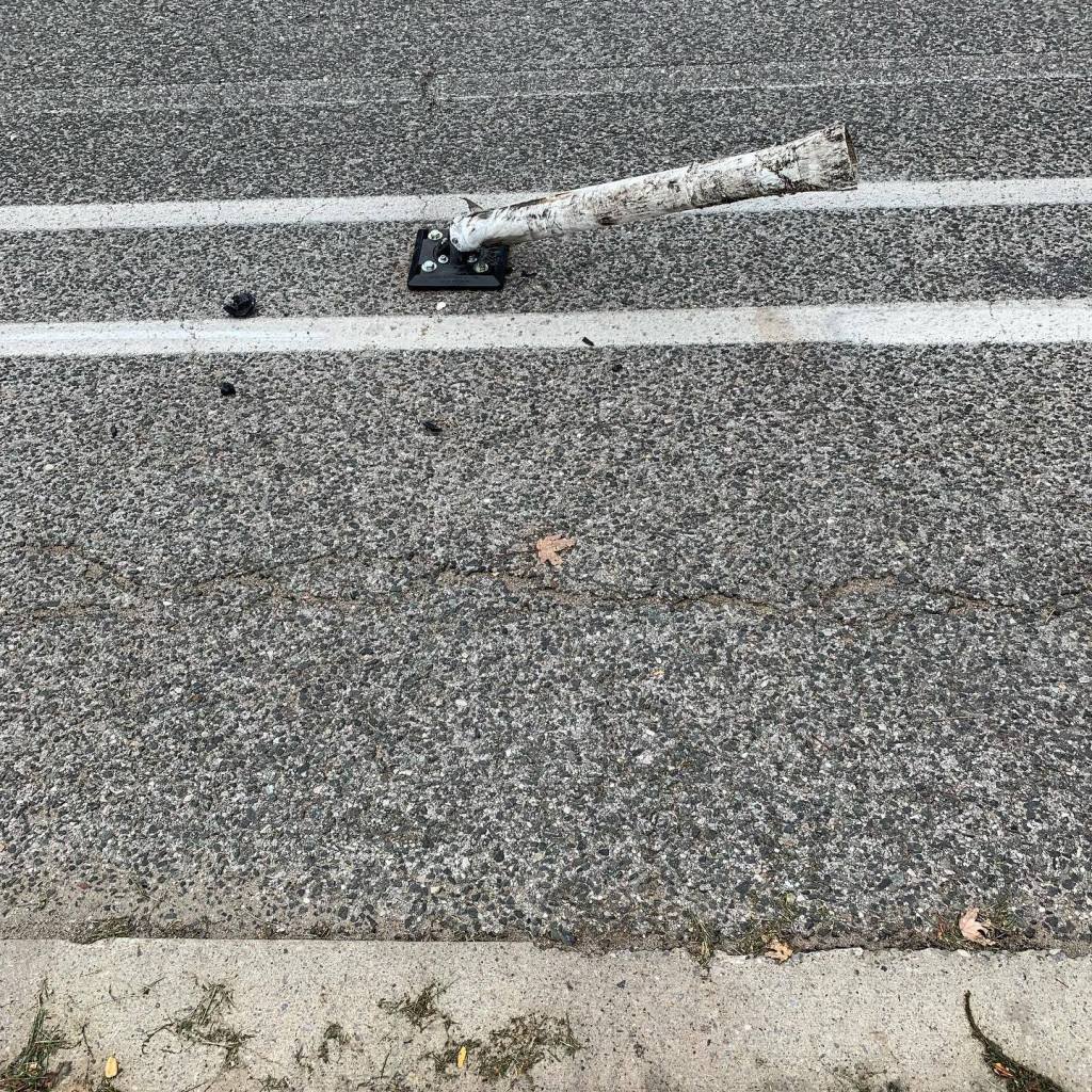
What happened here? This photo of a bent post on the cycle lane just east of where cars turn out of the parking lot at the Warden Plaza Shopping Mall onto Huntingwood Drive suggests that perhaps a motorist was going too fast and hit this post.
Here’s a photo of the exit from the parking lot at the Warden Plaza Shopping Mall where motorists would make a right turn onto Huntingwood Drive with the bike lane going east (or left turn to go west towards Warden Avenue).
The following quote is from page 18 in the section of the report describing Scarborough’s urban form:
The priority of Scarborough’s automobile-centred road
design was to enable smooth automobile travel, centred
on the development of a grid of arterial roads that would handle most trips, accommodate large amounts of traffic, and move cars through the system as fast as possible. These arterial roads connected with the 400-series highways, designed for inter-city travel, and local streets in neighbourhoods, which provided access to individual homes.
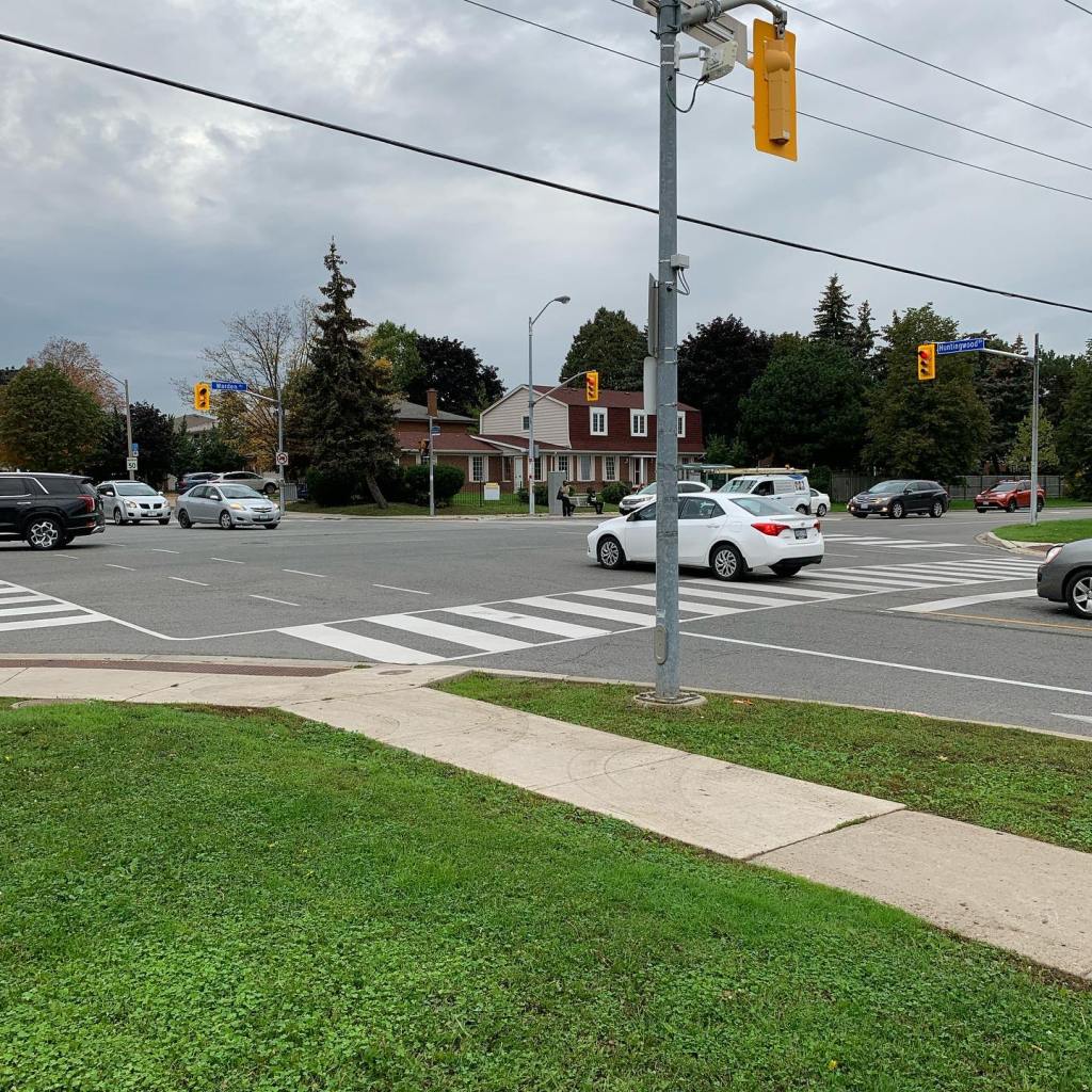
This is a photo of 4:30pm traffic at the intersection of Huntingwood Drive and Warden Avenue. It’s a short distance from the intersection to make a right turn into the parking lot at the Warden Plaza Shopping Mall. As I stood at this intersection observing the flow of traffic, it appeared to me that a cyclist travelling east on the cycle lane through the intersection would have to be very wary of any car signaling to make the right turn into the parking lot. Again, since I have not cycled in about 15 years, I invite anyone who has experience with cycling on these lanes to share their thoughts and feelings.
This final quote from page 4 in the Executive Summary of the report invites reflection on the proposed comprehensive active transportation network and recommends bold and urgent action on planning and implementation in order for the City of Toronto to meet the goals and objectives of its policies, guidelines and frameworks. These include The City of Toronto’s Official Plan, TransformTO, Toronto’s Complete Streets Guidelines, the City’s Vision Zero Road Safety Plan, and the City’s pedestrian and cycling frameworks (discussed on pages 10 to 16 of the report):
The report proposes a comprehensive active transportation network for Scarborough at the scale necessary to achieve existing City of Toronto policy targets. The suggestion is not that this is the only possible network, but that without a long-term plan for a comprehensive network, Toronto is unlikely to be able to significantly improve conditions for active transportation. It is past time to elevate our ambition and to transform Scarborough into a walkable, bikeable, and more livable place.
The City of Toronto must develop a comprehensive active transportation plan and a realistic timeline for building pedestrian and cycling infrastructure in order to achieve the City’s policy goal of dramatically increasing the use of active transportation in Scarborough.
This blog post is my first report on ‘citizen science’ discoveries on a walk in Scarborough-Agincourt along with some initial reflections on how the information and recommendations in “THE SCARBOROUGH OPPORTUNITY: A Comprehensive Walking and Cycling Network” report relate to my personal experience as someone who walks in Scarborough for utilitarian purposes as well as for pleasure and exercise (not necessarily mutually exclusive). I appreciate that the report includes an Appendix B with personal narratives by the authors. The sincere and candid storytelling in the narratives brings the report’s information and recommendations to life and inspires a sense of mutual responsibility to work as a community towards transforming Scarborough into the “walkable, bikeable, and more livable place” that we can imagine and make for ourselves and future generations.
